

A vast network of utility infrastructure is buried below ground, connecting ever expanding towns and cities with energy and data. Drainage systems, electricity, telecommunications, gas, water, and fibre-optics provide an invisible delivery of services which modern day life depends on. The ability to provide an understanding and accurate mapping of these underground assets is vital to any project where ground disturbance, construction and development is to take place, in order to:
- Minimise the risk of costly utility strikes
- Add value to planning and design of underground infrastructure
- Target key areas to avoid
- Improve the operational efficiencies of a site
At Dom Latham Ltd we have over 28 years industry experience in the detection and location of underground features, services and utilities. We use a common-sense approach and all currently available methods to provide detailed surveys of the underground assets that are present at your site.
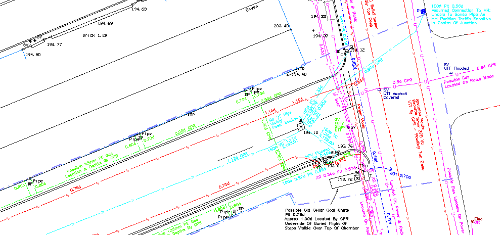
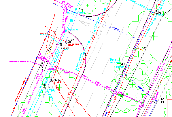
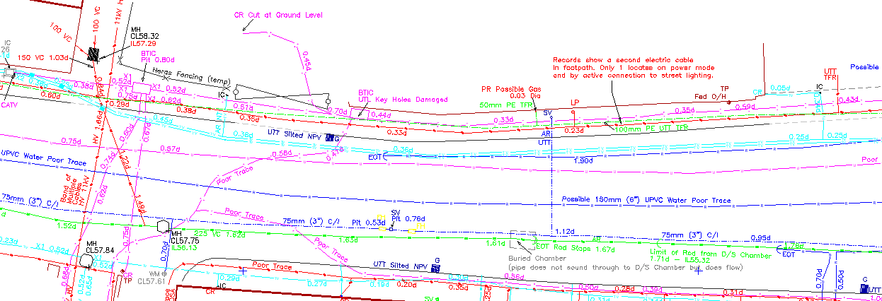
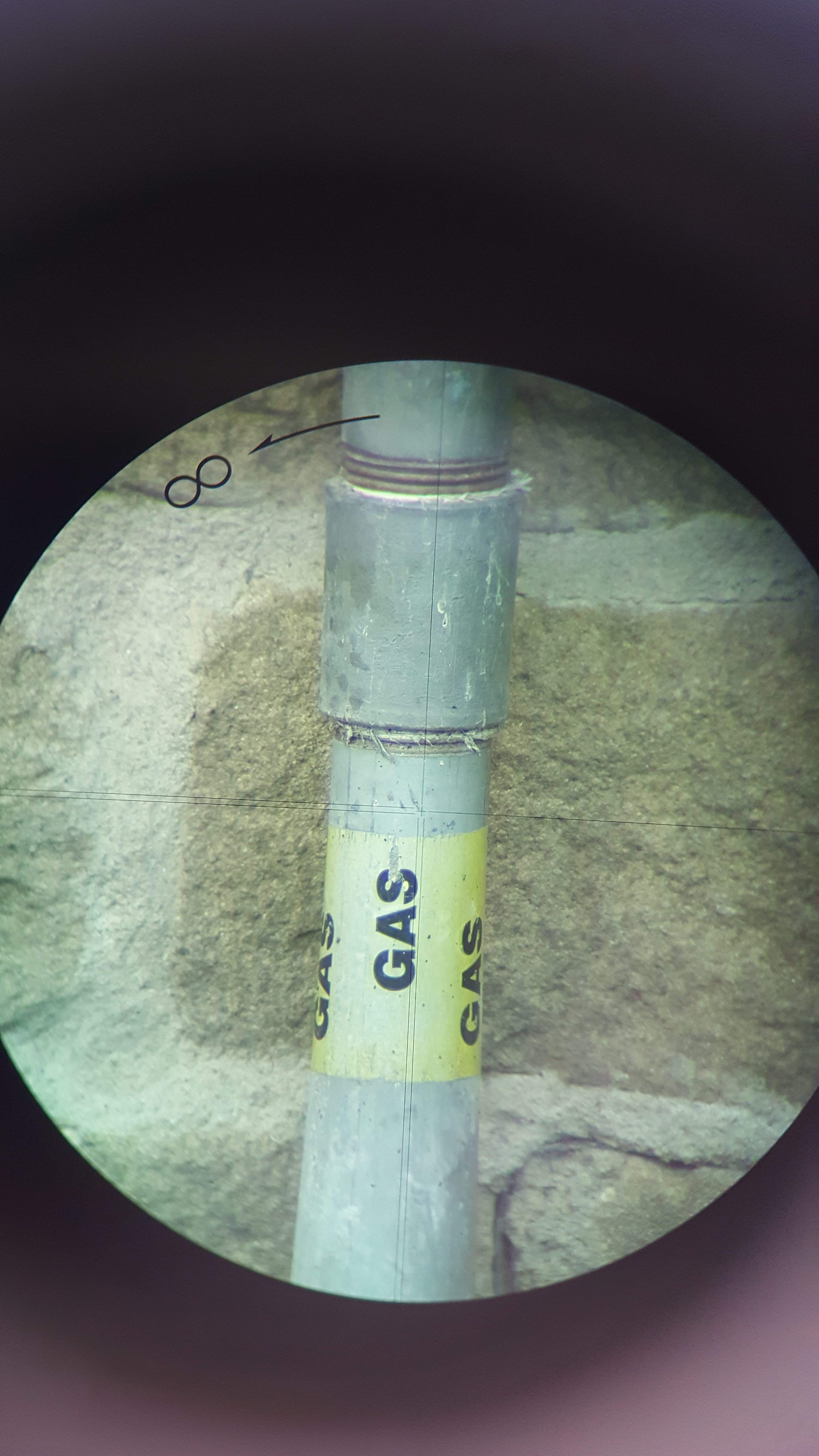
Utility survey examples:
To achieve these results, we have an extensive toolkit and array of equipment:
- Lifting manhole & inspection covers safely – this is a vital part of any survey as we need to access the underground services to allow us to trace their positions from the surface. Two types of lifter are used:
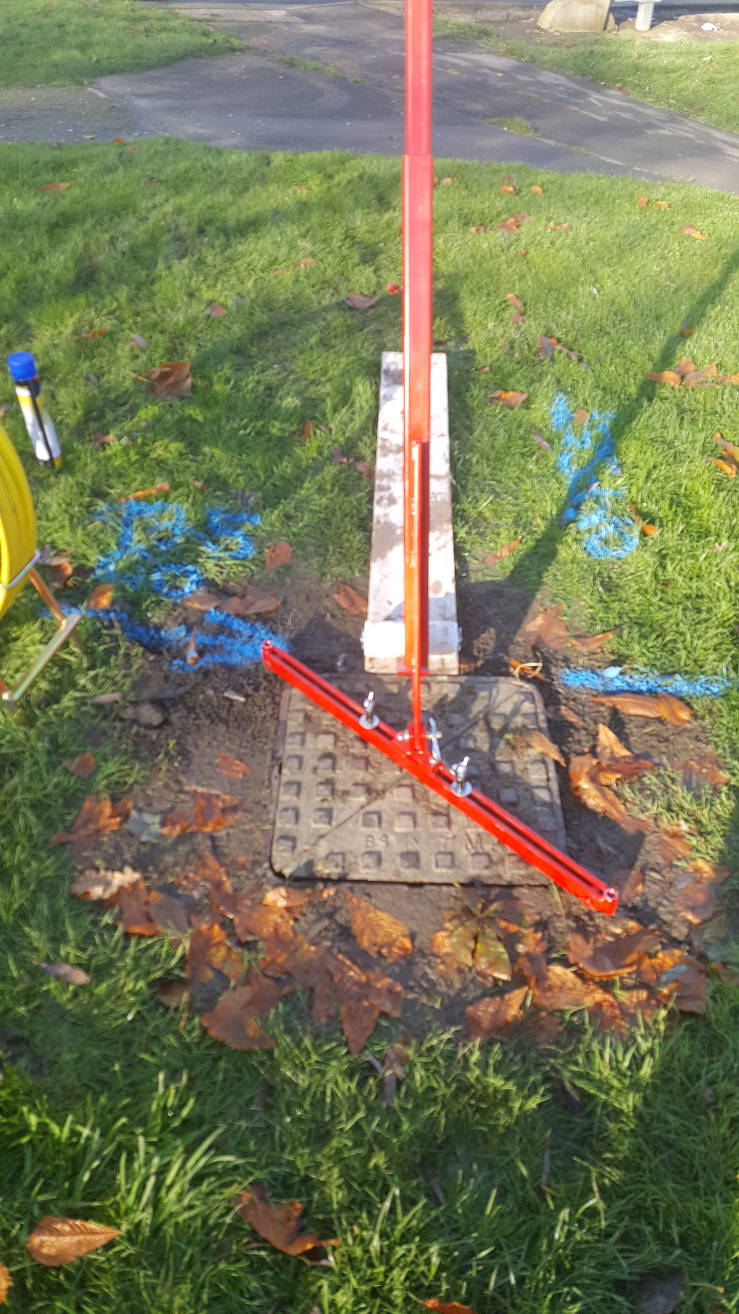
For split covers we have the Mustang Pivot Lifter. This has the advantage that the split halves are safely held together during the lift. It can be used on metallic and non-metallic covers, and features a seal breaker capacity for those stubborn situations.
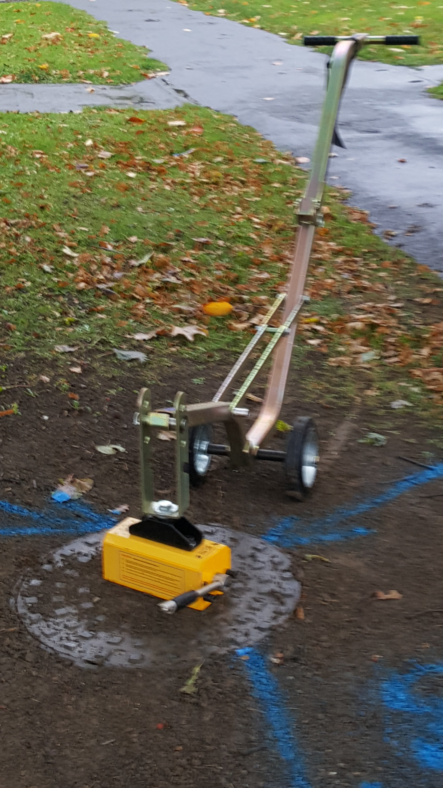
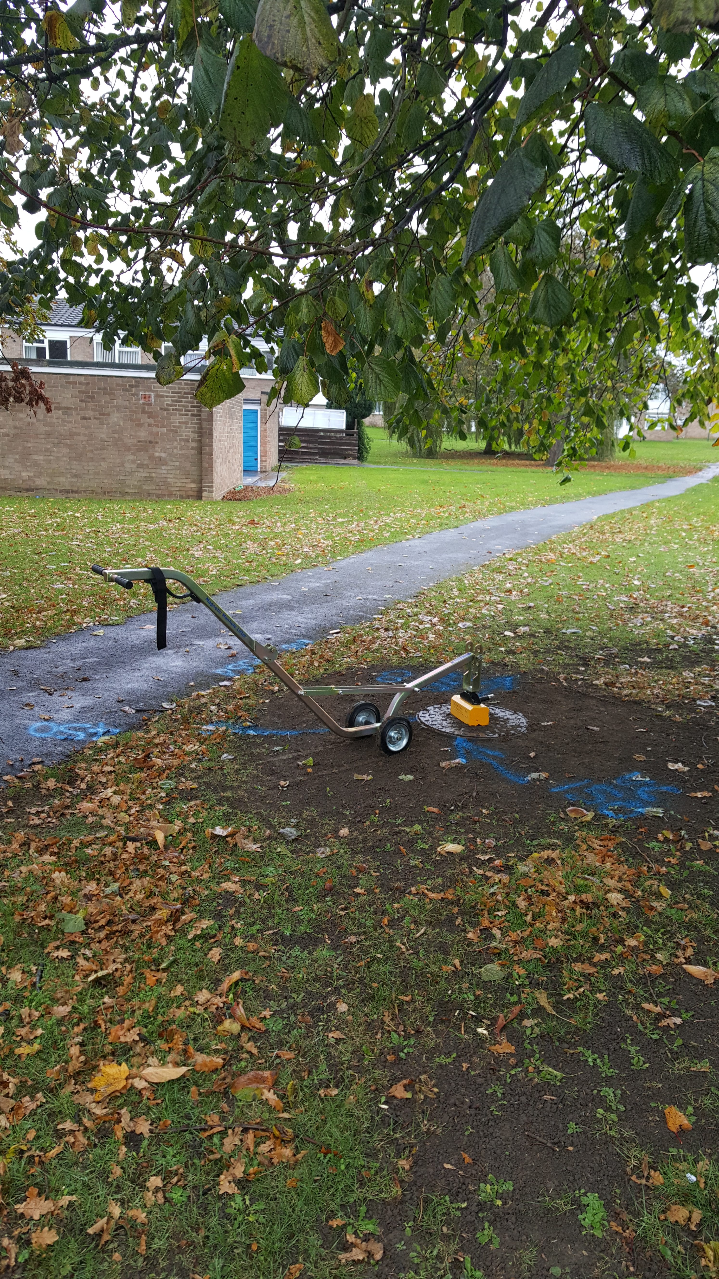
For general metallic covers we have the Magnetic Manhole Buddy. This has the advantage of one-person operation and the manhole keyholes do not need to be cleaned out leading to an efficient, speedy operation.
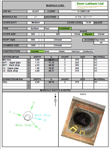
Example of a manhole card completed as part of an underground drainage survey.
- Electromagnetic Location (EML)
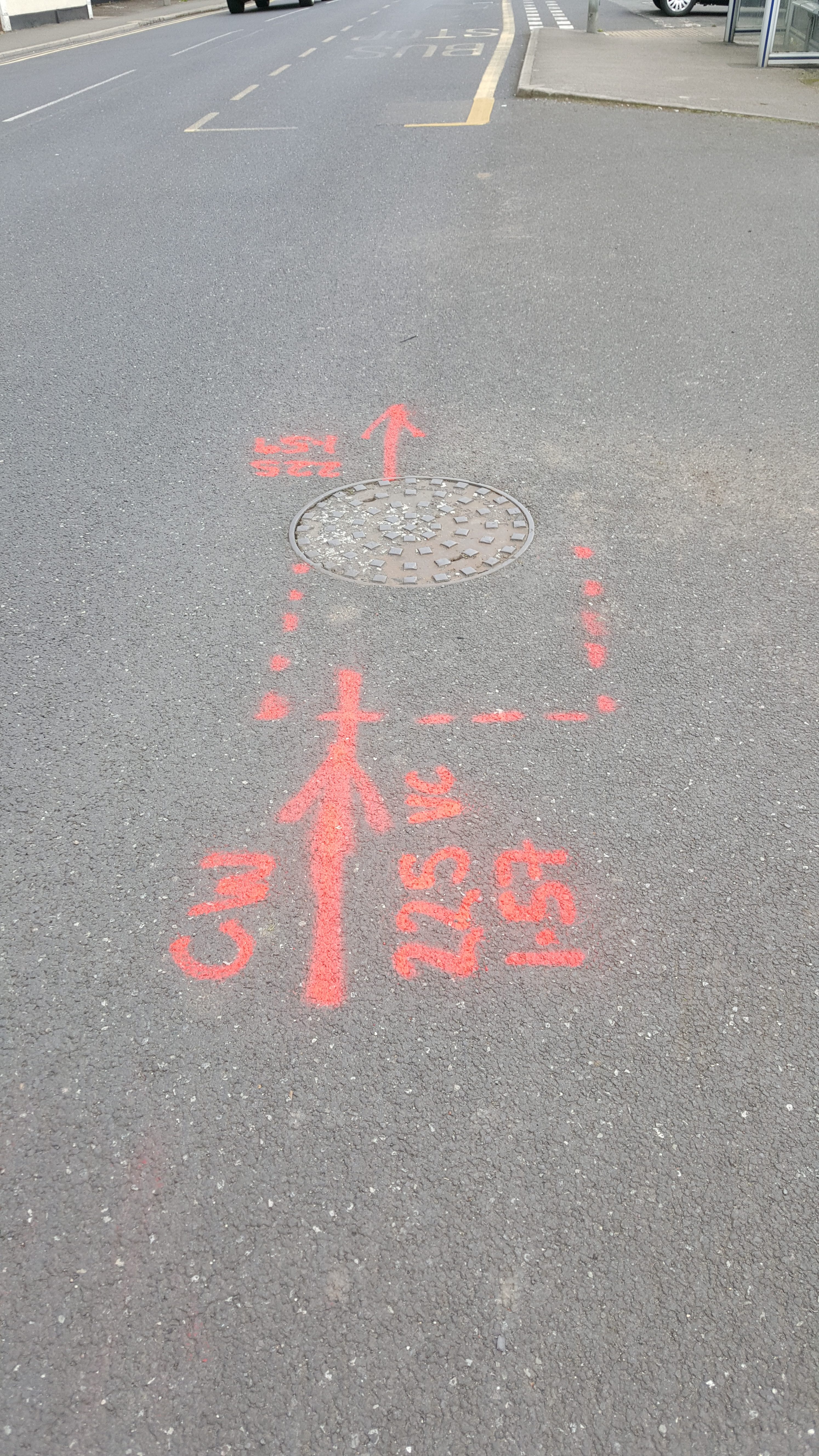
EML is one of the key techniques we use to detect and locate underground services. This versatile piece of equipment can be used in both ‘active’ and ‘passive’ modes. In an active connection the transmitter is connected to a service either by a crocodile clip or signal clamp in order to generate a signal into the service. Different signal frequencies are used depending on the nature of the service being traced. A receiver is then used to detect the electromagnetic signal passing along the service and hence locate its position. The transmitter can also be placed on the ground surface and used to ‘induce’ a signal into a service lying below, which is subsequently traced by the receiver.
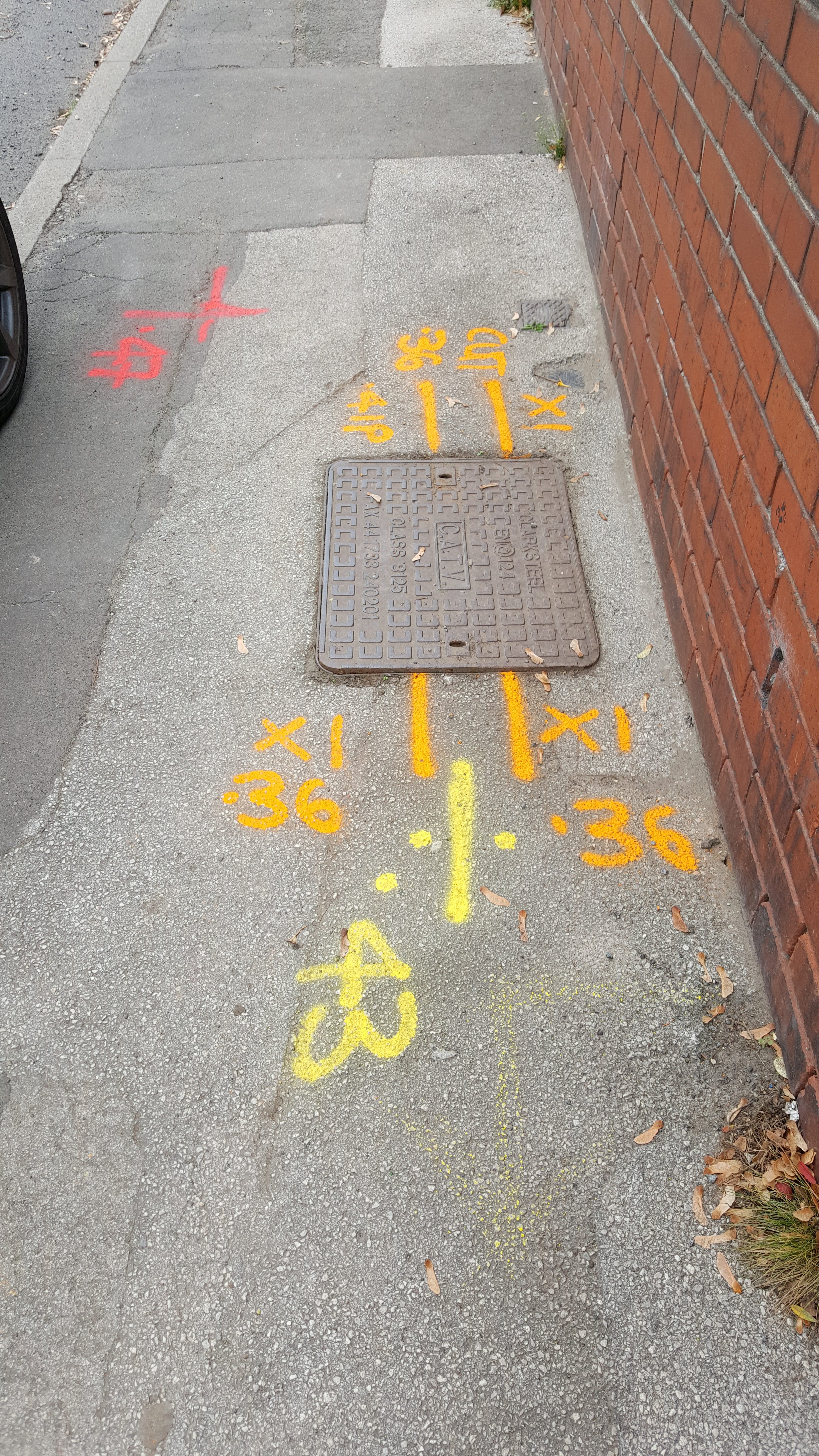
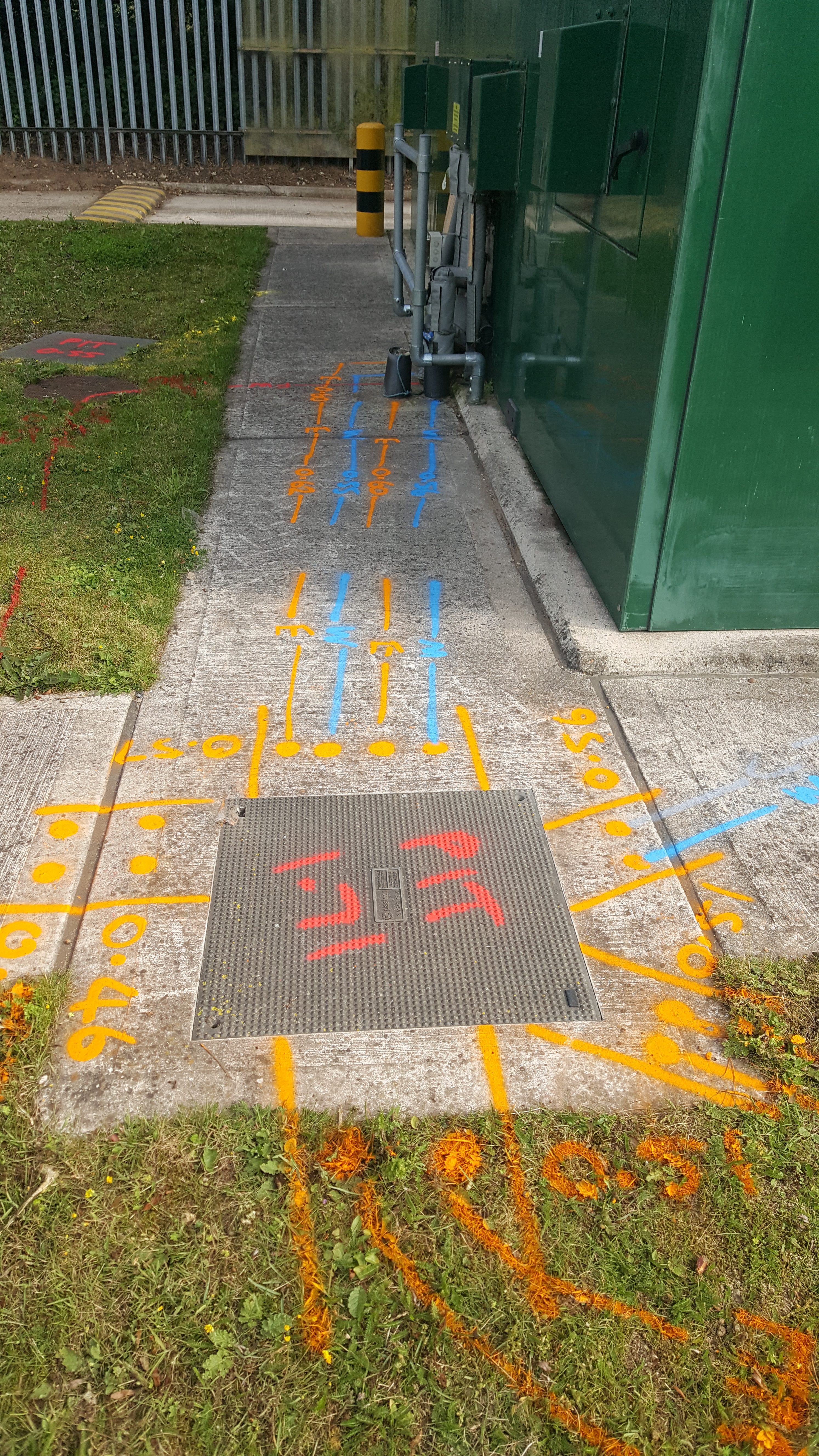
Service trace positions are usually marked in non-permanent paint on the site surface.
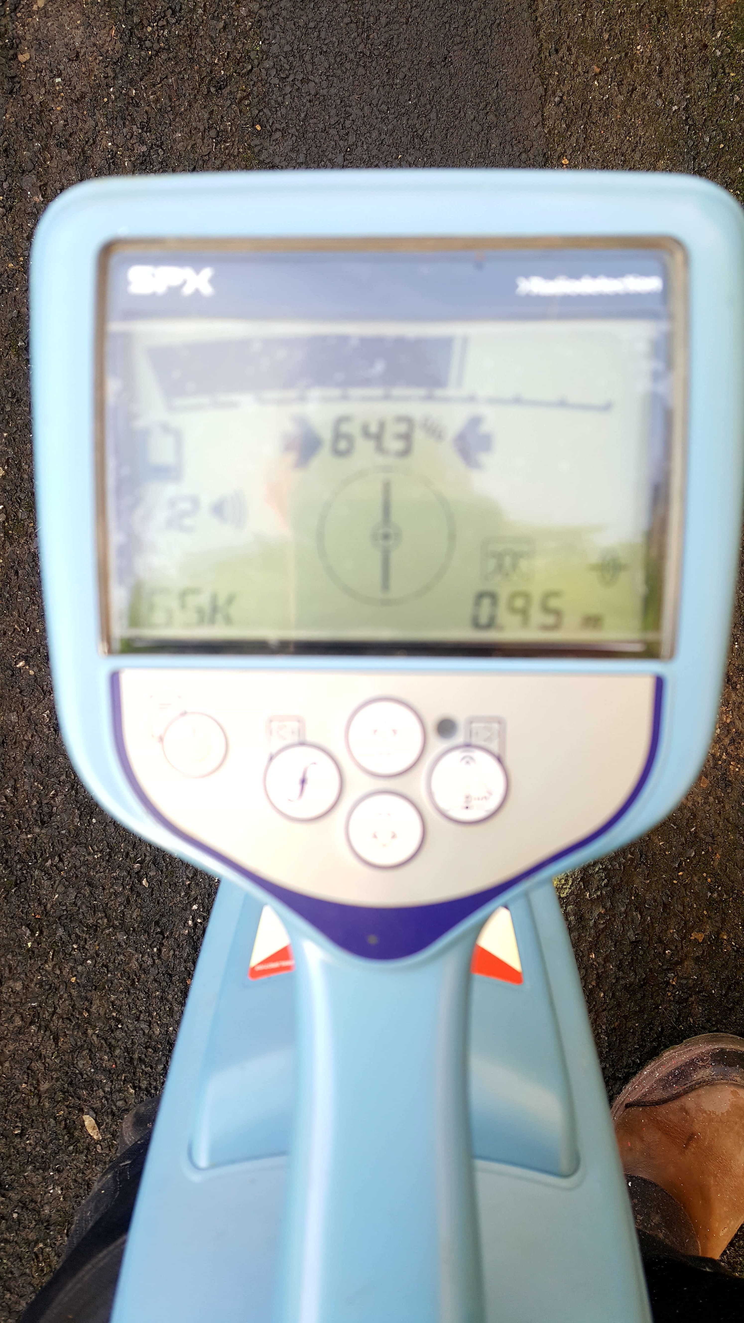
In passive mode the receiver alone is used to trace naturally occurring radio or power signals emitted from services.
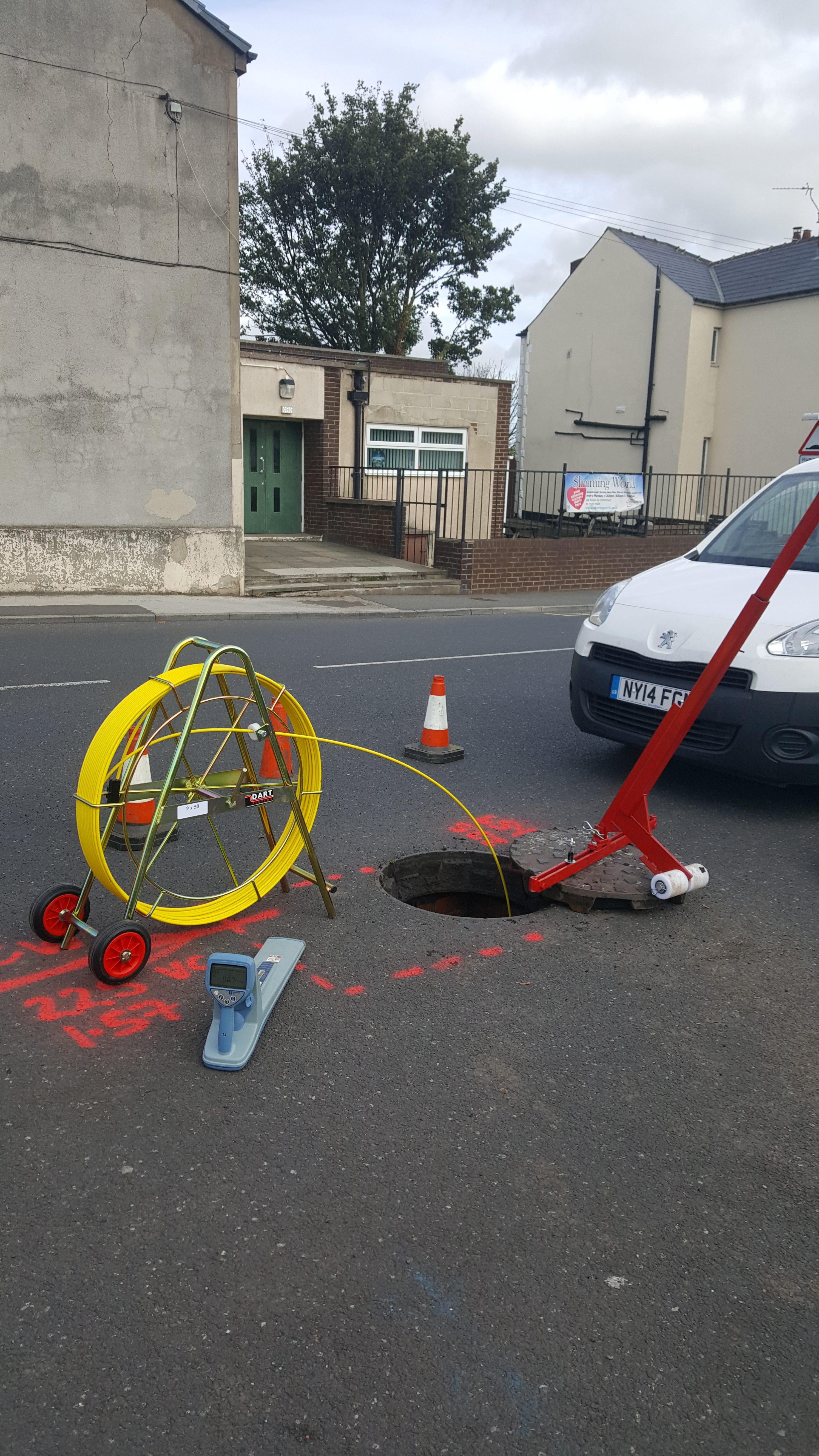
A transmitting sonde is also used by introducing it into the drainage pipe on the end of a ‘rod’, allowing the pipes position to be traced from the surface by the receiver.
- Ground Penetrating Radar (GPR)
GPR is used to complement the other locating techniques. It is the only currently the only equipment that can detect metallic and non-metallic underground features – as such it is particularly useful for locating plastic (PE) pipes.
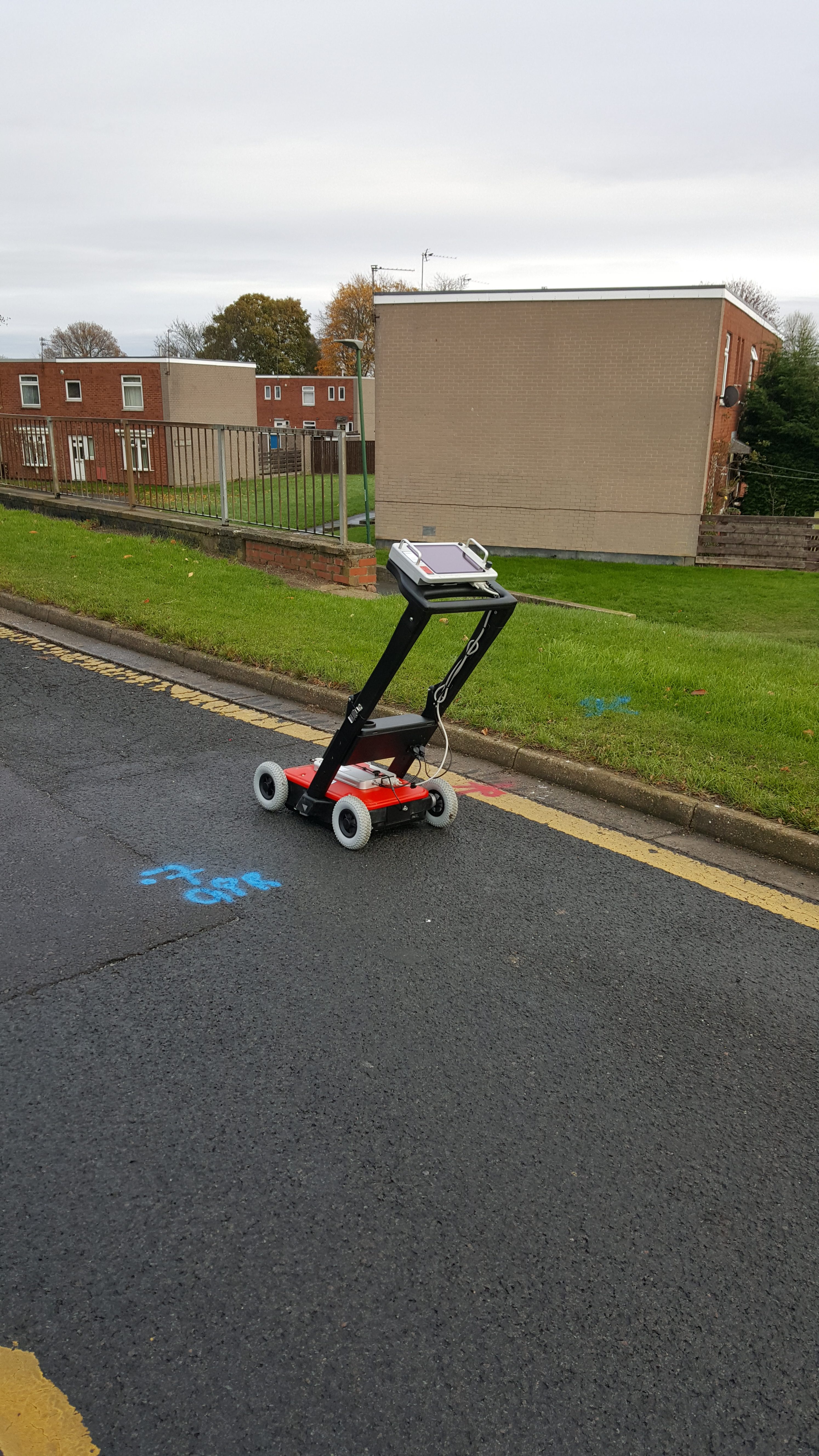
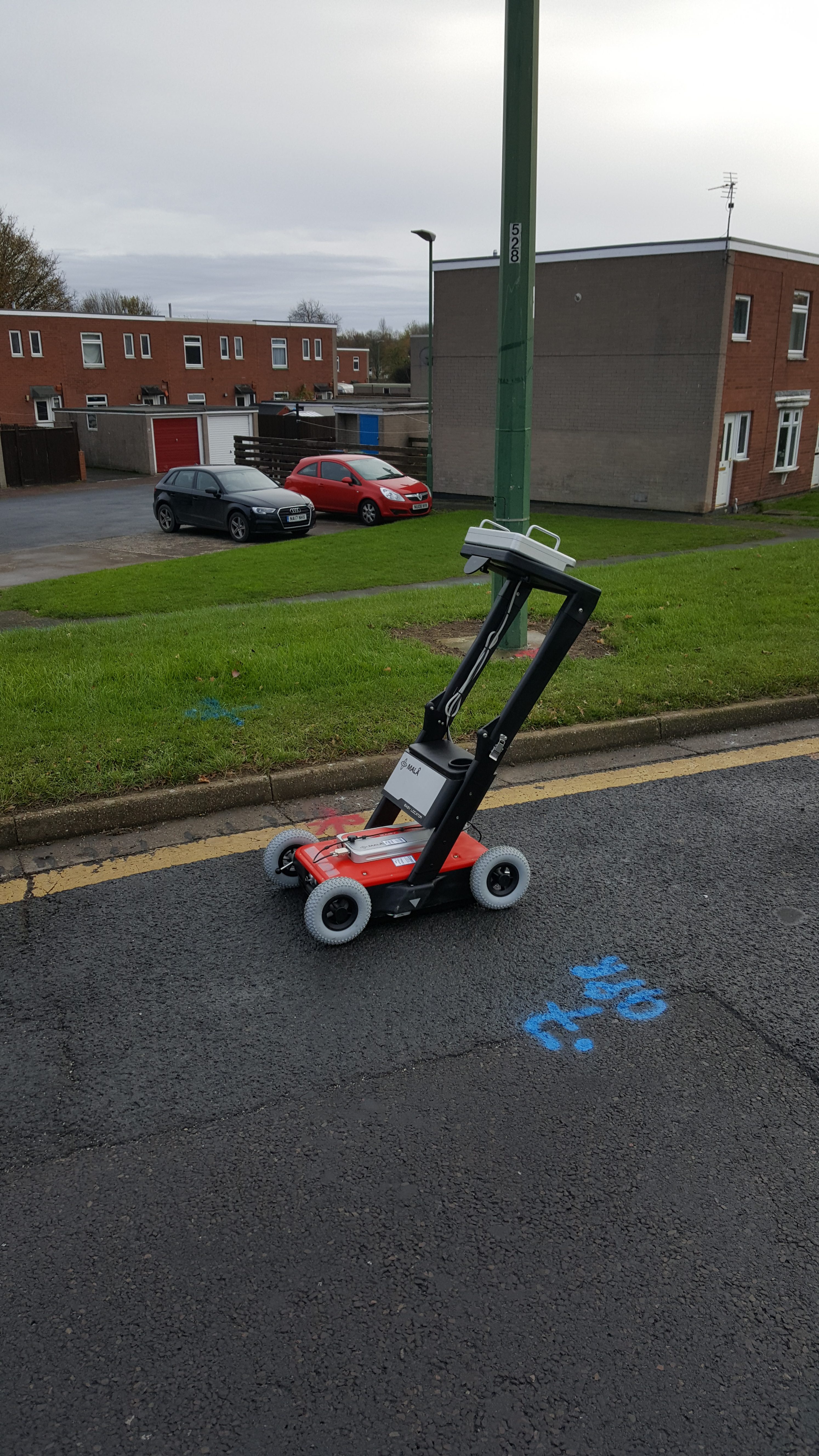
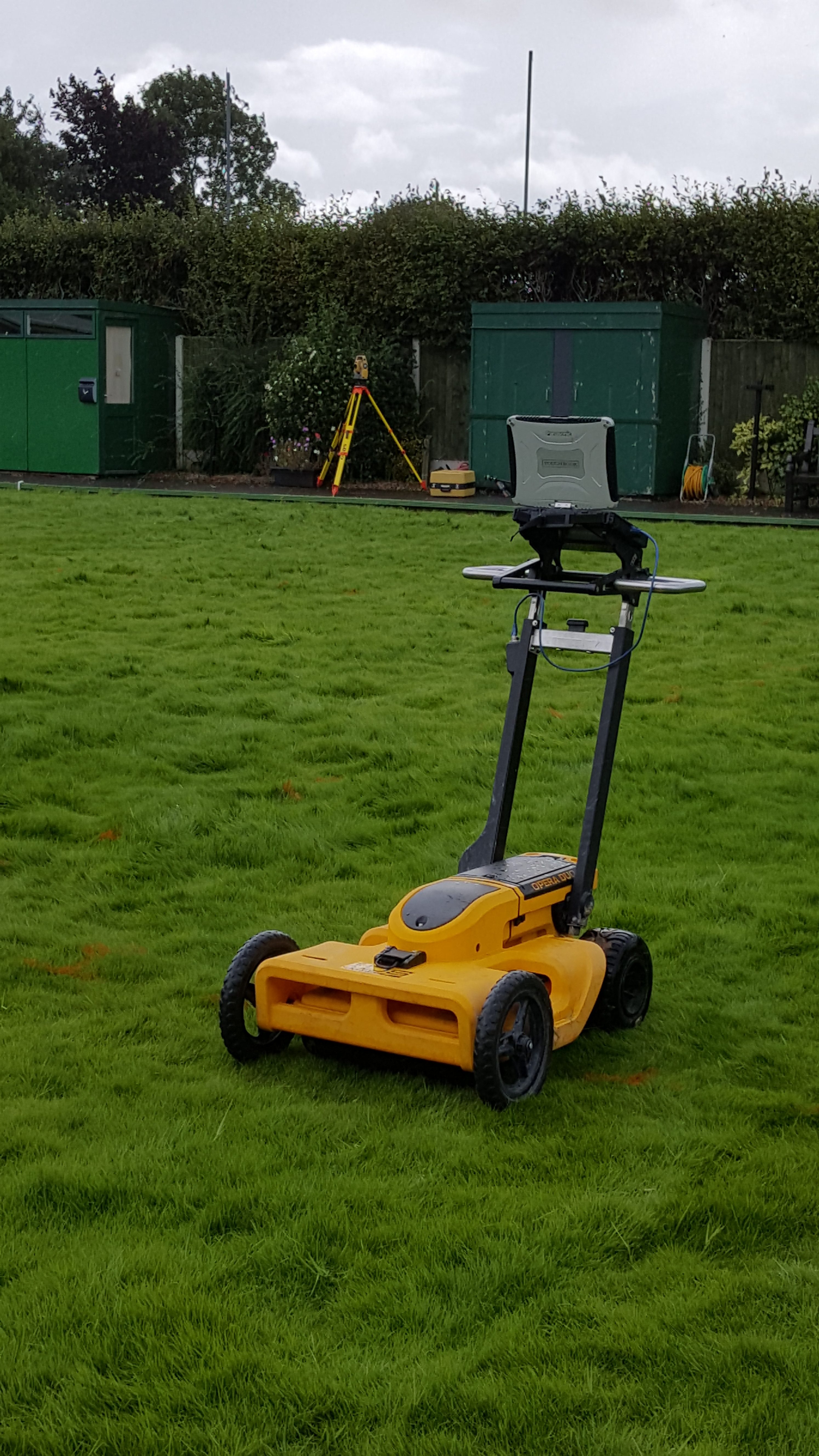
When the wheeled cart is pushed along the ground surface the GPR reflections (or signatures) of any objects buried beneath are displayed as hyperbolic curves on the data processing screen:
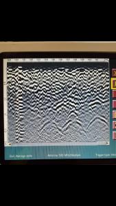
GPR reflections from underground fuel storage tanks during a petrol forecourt survey. The three large curves at the bottom centre / right of the image are the signatures from the top of the buried tanks at 1.7m deep.
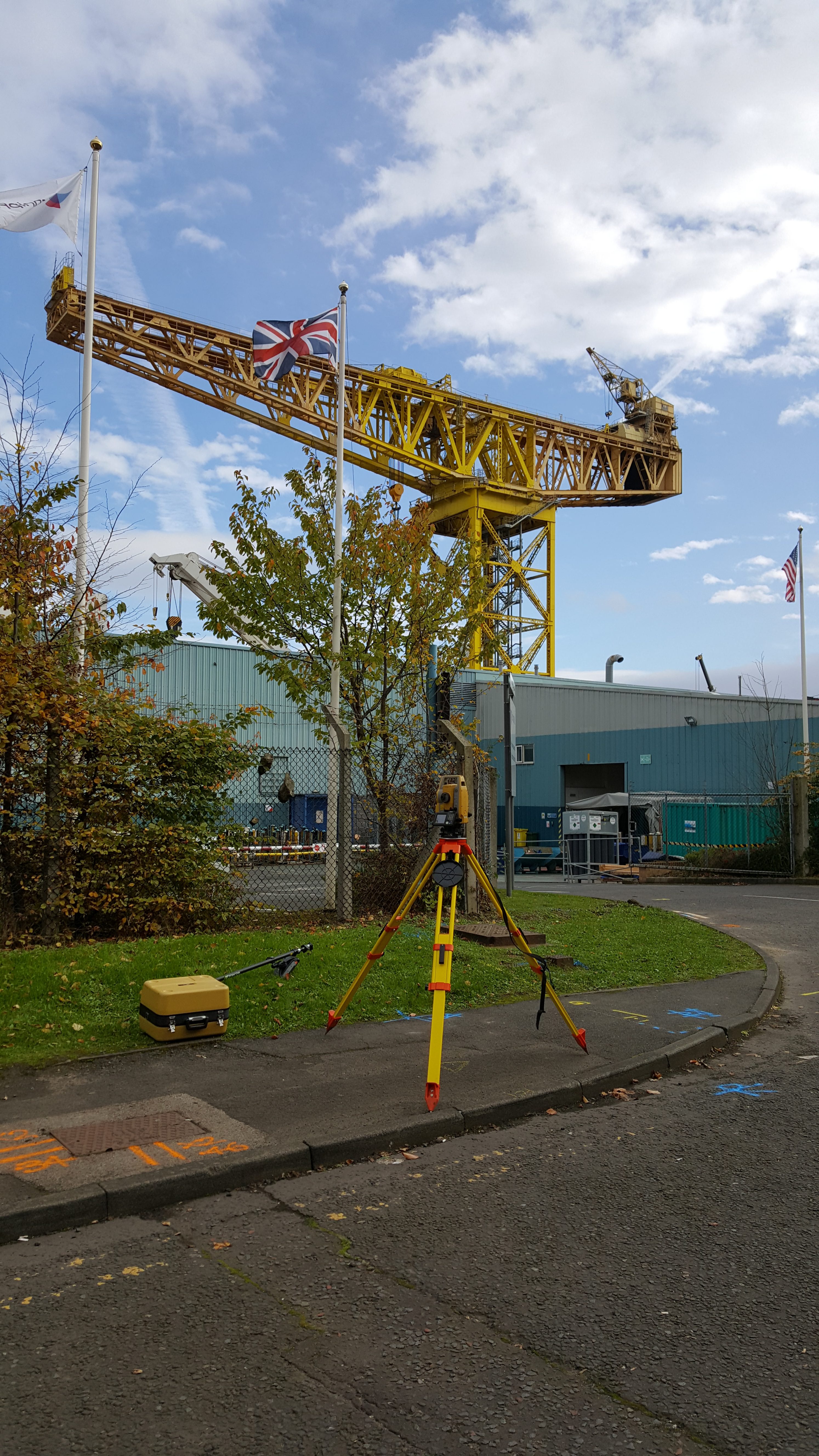
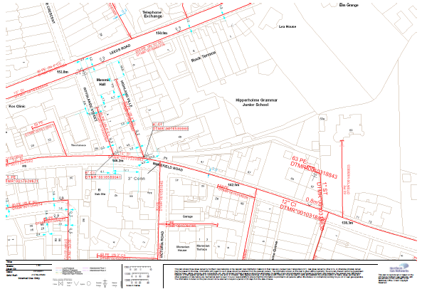
To produce the final drawings the traced utility locations are surveyed in on site using total station and or GPS resulting in the production of a concise, content rich, accurate survey.
- Underground Utility Statutory Records Searches
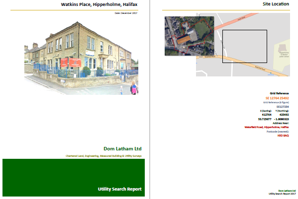
We are able to provide searches for all underground statutory undertaker’s utility records and provide these as a hard or soft copy report. This information is a vital starting point for any of our underground utility surveys, but can be provided as a stand alone deliverable.
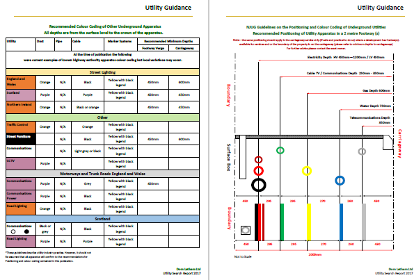
All work is carried out to the RICS professional guidance, global, Measured surveys of land, buildings and utilities 3rd Edition; undertaken to RICS terms and conditions of contract for land surveying services, 3rd Edition (2009). We also undertake utility surveys to PAS128 and TSA specifications.
Our utility survey work is fully complemented by our extensive in house topographical and land survey capabilities. .